Moab, UT - Arches National Park

I thought Arches would be a bit archier...
The road in Arches is a two-lane road and visitors slowly meander along, passing rock formations, overlooks, and trailheads in a single file line. What I did not expect in Arches National Park was for us to drive for 30 minutes without seeing a single arch! All of the arches were not exactly easy to find without the technology that exists today. A group of arch-hunters helped to survey the park and they were able to find and document over 2,000 arches.
We only have one rule - keep off the arches!
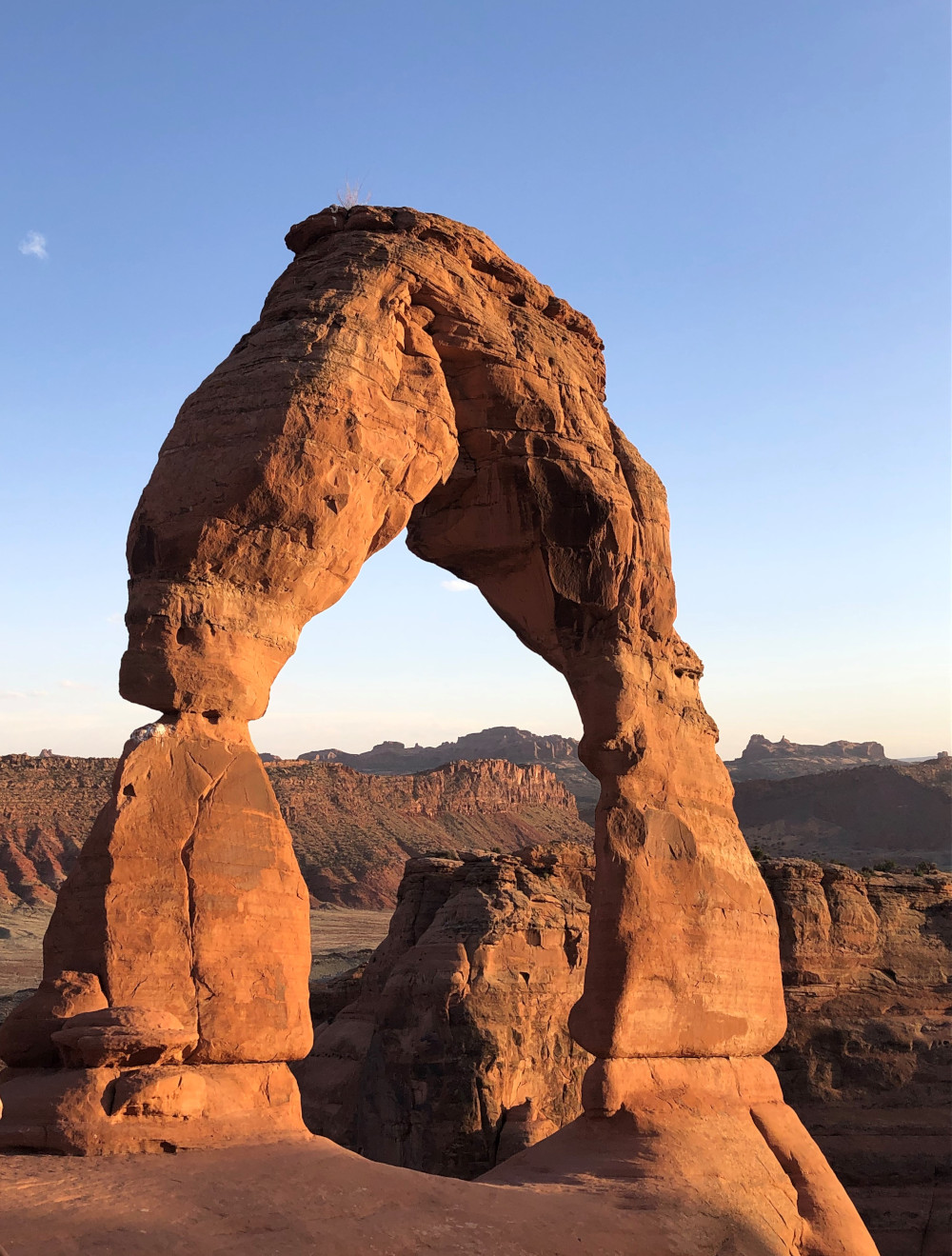
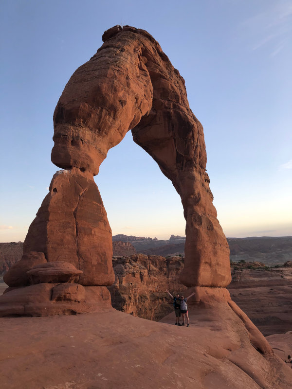
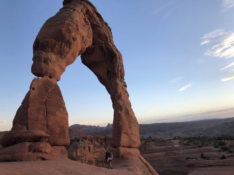
We decided to hike the Delicate Arch Trail at sunset. This is another very popular hike, because Delicate Arch is the largest freestanding arch in the park. You won’t realize the magnitude of this arch until you are standing under it. It was another incredibly windy day (way to keep it consistent Utah!), especially at the top of the trail. There were large crowds of people waiting to get a picture with it, others resting from the steep incline of the hike, and some just gazing at it, trying to take it all in while the sun was setting and the colors of the surrounding landscape changed.
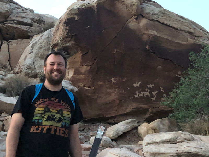
On the way down, there is a short trail that leads to petroglyphs (rock carvings) of bighorn sheep and people riding horses. It is amazing how well preserved the carvings are.
Devils Garden
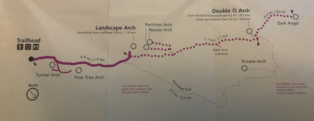
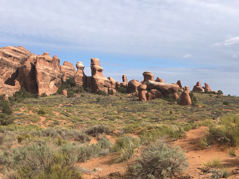
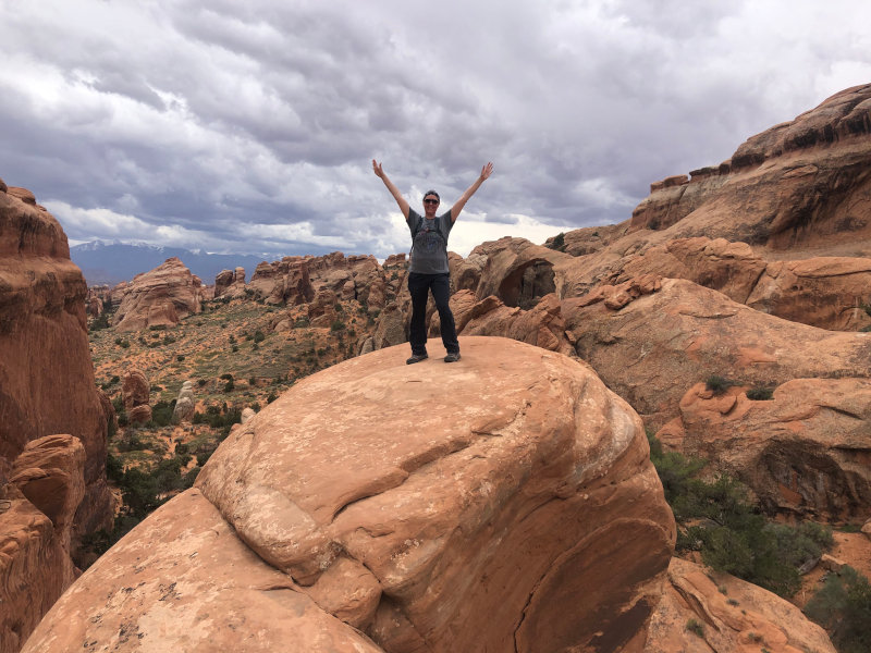
What better way to spend our last day in Moab than hiking through Devils Garden? This hike is incredibly popular, but there are varying degrees of difficulty you can choose to do on this hike. You can do a quick two-mile hike, see three arches, and call it a day, you can go five-miles and see six arches, or you can do the primitive trail, which is eight-miles and allows you to see eight arches. We decided to do the primitive trail, because did you even go to Arches if you don’t see ALL the arches? We also wanted to do this one, because this trail is off the beaten path and requires scrambling up and over rocks.
It was another early start that morning. It took us 30 minutes to get to the entrance of Arches and Devils Garden is all the way at the back of the park, which takes about 45 minutes to drive to. We arrived at 8 am and were welcomed with an almost completely full parking lot and there is a HUGE parking lot. As we walked up to the trailhead, we heard a ranger telling others that the park was already at full capacity and they weren’t letting anyone else in.
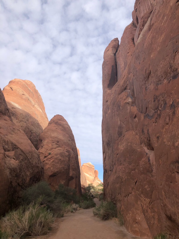
The beginning of the trail was a bit chaotic. Huge crowds filling up water bottles, applying sunscreen, waiting in line for the bathroom, taking group photos, and looking at the trail map. Once you get past that, you walk between towering fins, anticipation building until you finally round the corner and are treated to your first view of the landscape.
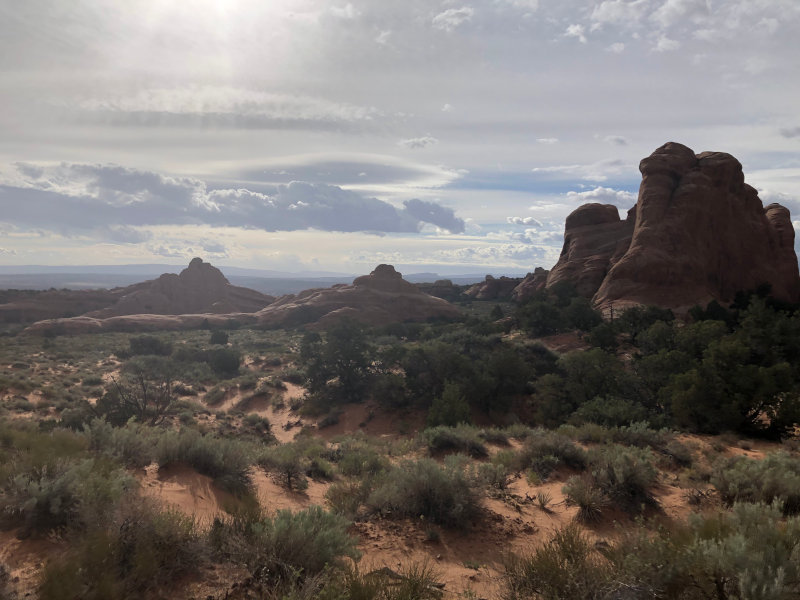
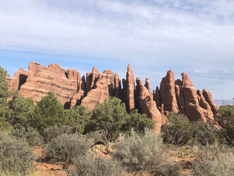
Quick geology lesson! Fins are narrow rock walls formed by erosion and fracturing of larger rocks. Rainwater and snowmelt get into cracks in the rock, eroding and widening the cracks. In the winter, water within those cracks freezes and expands, causing chunks of rock to break off. Weak areas of fins continue to dissolve and crumble off over time, resulting in arches.
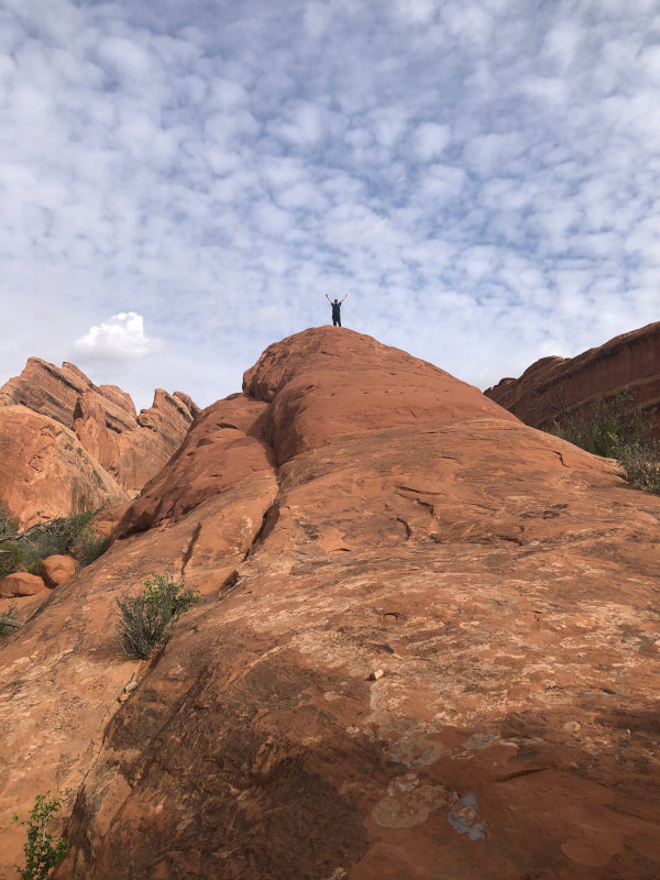
We weaved our way in and out of the crowds for less than a mile and then reached the fork in the trail. We were the only two who veered to the right, happily trading the paved trail for the red dirt primitive trail. After just a few minutes, the noise of the crowds had faded away and we were left to ourselves to explore this crazy garden of juniper trees, pinyon pine trees, and cacti. Did I mention you get to climb up the giant fins?
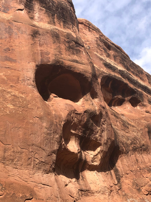
We came across a rock with a unique erosion pattern. I see a baby doll face. What do you see?
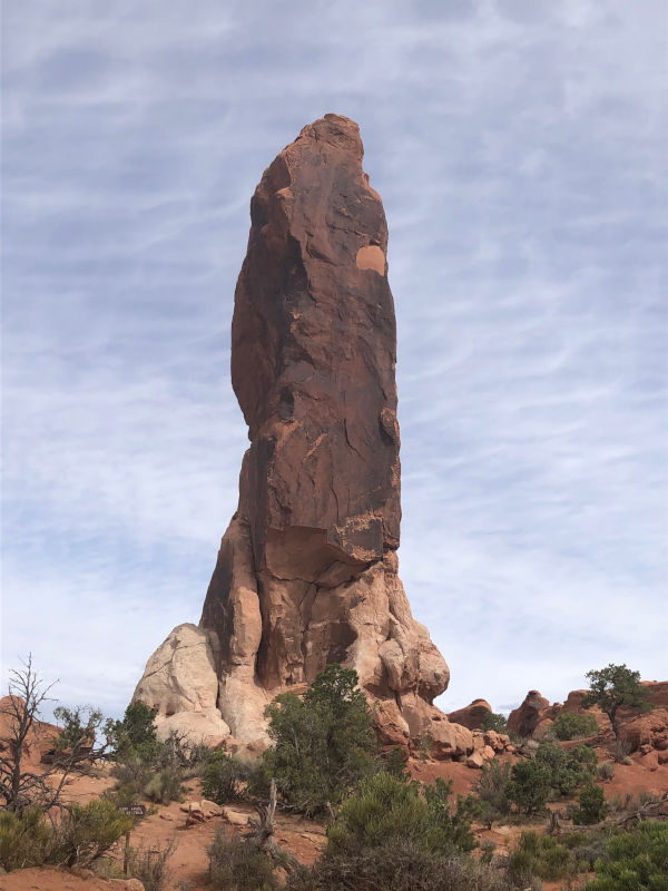
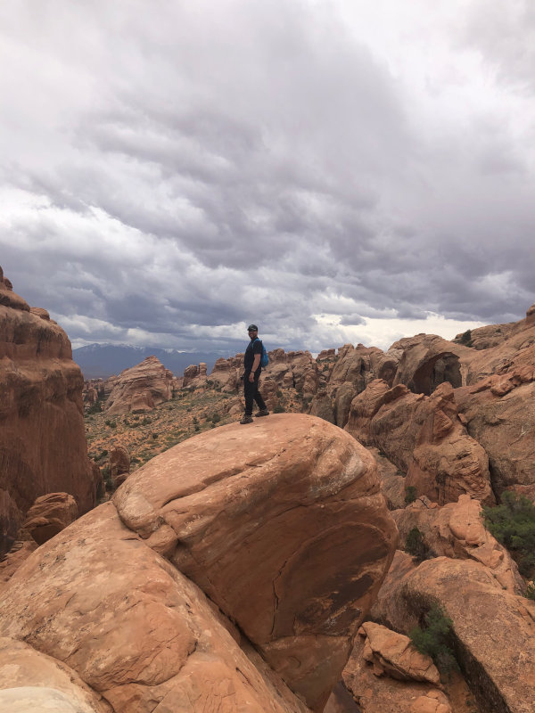
After over a mile of scrambling up, over, and along rocks, we finally came across our first arch - Private Arch. It was anything but private when we arrived, so we quickly took some pictures and continued on our way. At the furthest point of the trail, we caught a view of Dark Angel, which is a tall, dark spire that looms over Devils Garden.
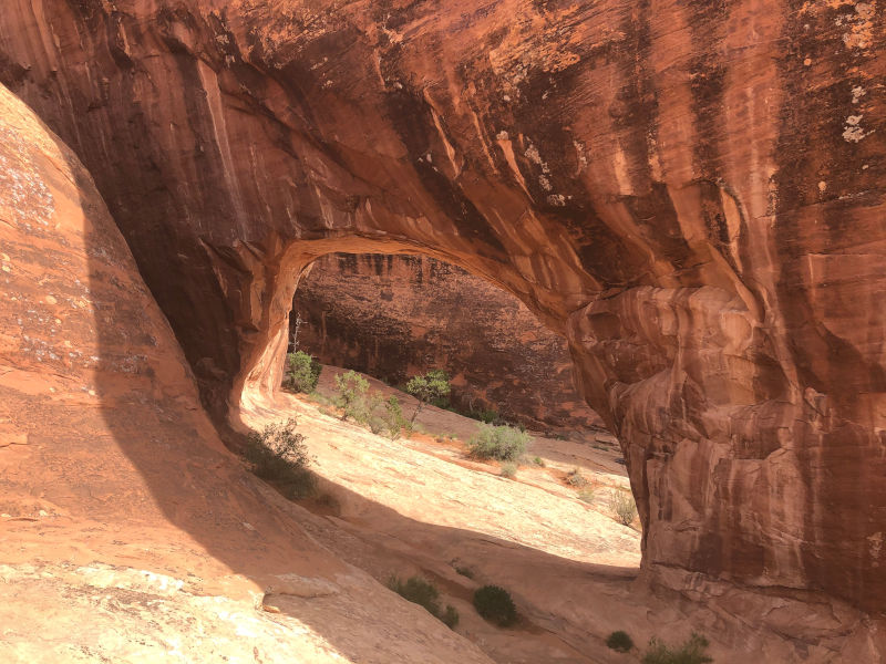
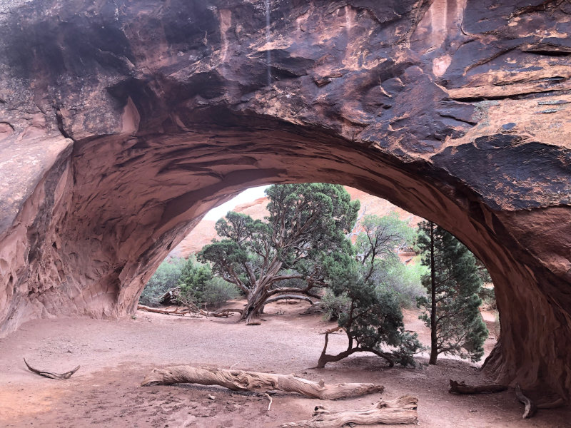
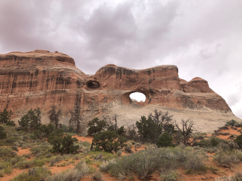
Then we came across Double O Arch, which was incredible! There is one giant hole eroded through the top of the fin and a second smaller hole at the base of the same fin. Definitely worth the extra miles to see!
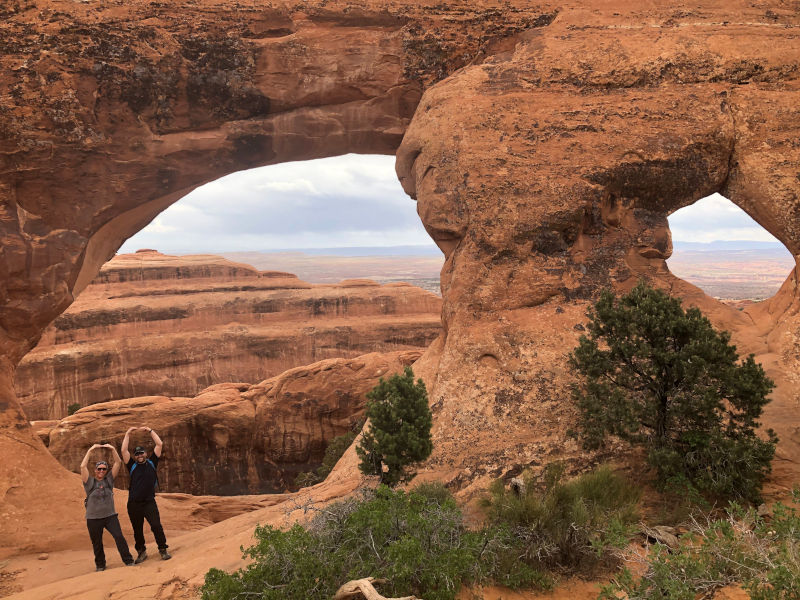
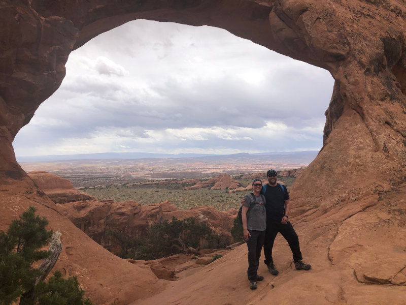
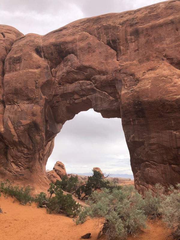
After viewing Double O Arch up close, we scrambled up and over another giant fin and viewed it from a distance. Further along the fin, we came across Black Arch overlook. Continuing on, we had to branch off the main trail to find Navajo Arch and Partition Arch. Luckily, we came across two women who had spent 15 minutes finding the perfect spot for that Instagram worthy pic and they offered to do a mini photo shoot for us. Thanks ladies! Both of these arches were worth putting in those extra steps.
Back on the main trail, we navigated our way along another long row of fins. It was a bit nerve racking at times when we had to pass people on the fins and some people would get dangerously close to the edge to take pictures. It started raining as we descended another large fin, which we gladly welcomed as it cooled us off a bit.
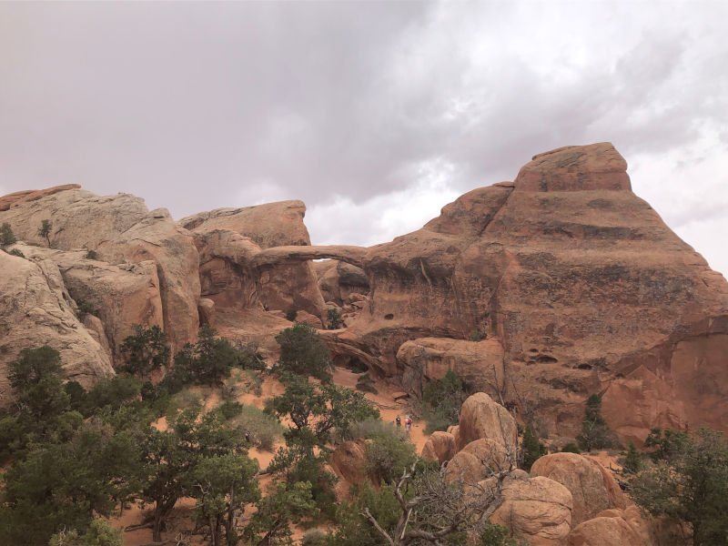
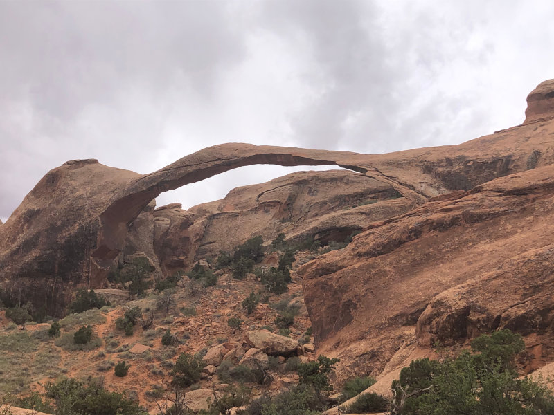
We came to a particularly precarious edge, took some pictures where it looked like we were up in the clouds, and this is where we finally caught a view of Landscape Arch, the longest arch in North America. It is 306 feet long and so incredibly narrow, it looks like it is hanging on by a thread. Visitors have not been allowed to walk under the arch since 1991, when a 60-foot section of the arch broke off. There are some larger remnants still evident below the arch.
On the way back to the trailhead, we branched off one last time to see Tunnel Arch and Pine Tree Arch. We did it! We made it to all eight arches. As we slowly made our way back to the car, legs aching, we discussed what a remarkable hike it was.
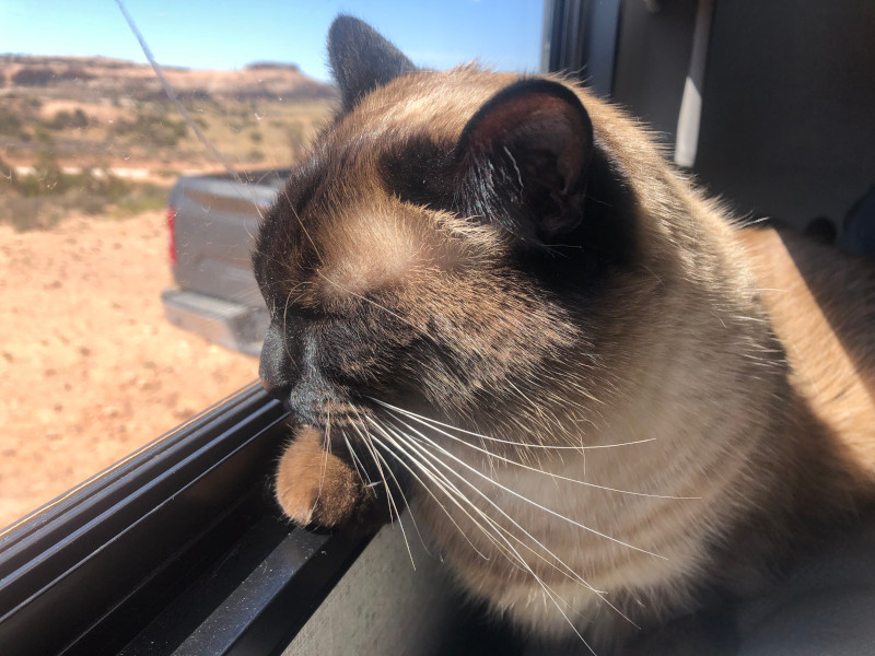
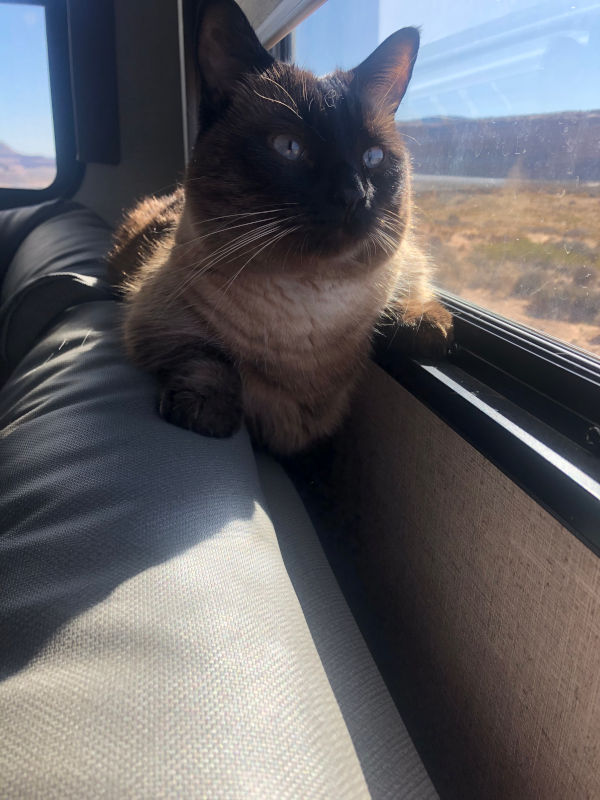
Moab – Lumpy approved.
Despite the wind causing poor little Lumpy to go into hiding, she still managed to enjoy herself in Moab. She found several new spots in the trailer – one where her brisket could hang freely, one where she could sunbathe, and she decided my body was a pretty comfy spot to sleep on. And don’t forget more screen time!